Climate modelers can’t agree on the Mississippi River’s future. Northeastern professor Samuel Muñoz is settling the debate.
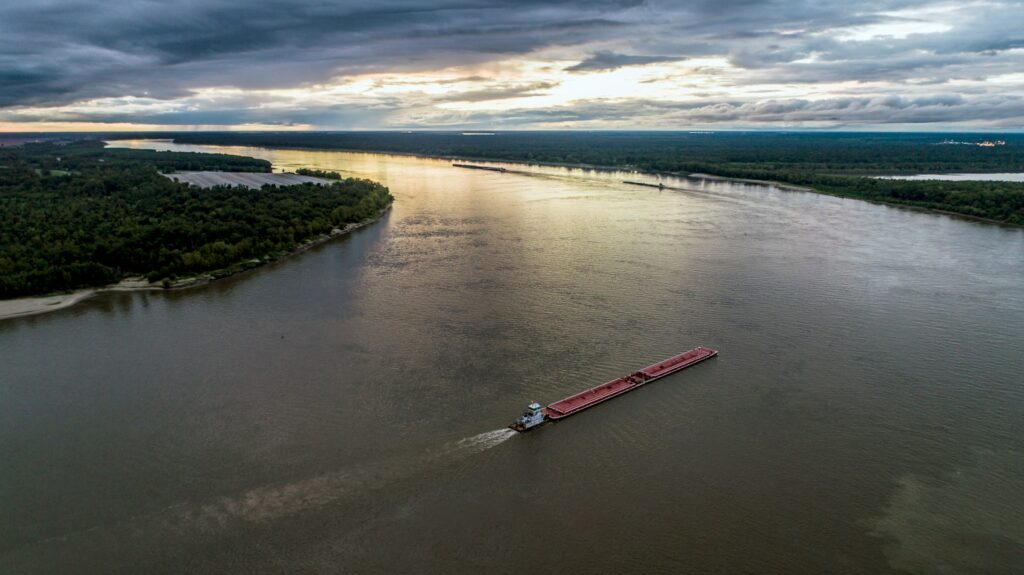
The Mississippi River, an ecological, cultural and economic hub of activity, is dangerously misunderstood — at least, by climate modelers. The river supplies drinking water for more than 50 cities and 15 million people, and it supports almost 40% of the bird and fish species in North America. And yet, we still don’t know whether in the coming decades it will flood into surrounding land or shrink down to a dry shadow of its former self. That’s because, among the three global climate models that can actually simulate the Mississippi River’s water level, there is stark disagreement.
“We’re at a point in terms of uncertainty where the models don’t even agree on the trend, let alone the magnitude,” says Samuel Muñoz, Associate Professor at Northeastern in the Coastal Sustainability Institute, Department of Marine & Environmental Sciences and Department of Civil & Environmental Engineering. Muñoz’s research team tests which models are most likely to accurately predict the river by looking at the models’ track records.
The disagreement is a major problem for government-employed water managers who work to ensure that towns and cities have enough drinking water and who monitor infrastructure like dams, levees and reservoirs. They need accurate information to determine whether they should focus on mitigating flood damage by building physical barriers and creating stormwater drainage systems, or remedying drought by finding alternative sources of water and incentivizing water-conserving infrastructure.
The models simulate the world’s climate with supercomputers, accounting for dozens of factors from precipitation to temperature to wind to snowmelt. They focus on general trends and patterns in the global climate. But Muñoz is interested in the Mississippi: a small, local detail in the global picture. The problem is, the complexity of the relationship between global climate dynamics and local river systems creates a lot of uncertainty in the model predictions.
“Every river in the world can be different,” says Muñoz. “With water, it’s really messy. Some places are going to get drier, other places are going to get wetter.”
To get a better sense of which models can predict the future, Muñoz’s team first looks at their track records of predicting the past. They run each model through a test, seeing how well the output aligns with the team’s plethora of historical flood data on the Mississippi. The theory is that if a model can accurately predict the past, it is more likely to predict the future.
But collecting data to validate models isn’t easy. Direct measurements of water levels — primarily from the U.S. Geological Survey, a federal water resource management group — sometimes only date back 10 years. So, research teams including Muñoz’s collect data across the Mississippi basin to supplement the short history of direct readings. They scan historical flood documents, identify scars in tree rings caused by flooding, look for coatings on cave mineral deposits from floods and analyze the distribution of lake and river sediment.
The team’s first target in their expansive survey of models is the Community Earth System Model, or CESM. It’s a collaborative public climate model developed in the U.S. and one of the three global climate models that directly outputs water levels for the Mississippi River. The research team found that the output agreed with their extensive and diverse library of historical data — a good sign for its ability to predict the future and a first step in the effort to clear up uncertainty around the river’s future.
The CESM’s prediction: The Mississippi’s water levels are going to rise in the coming decades. If it’s correct, “you’d have a lot of damage and potentially some loss of life,” Muñoz says. “It would also probably mean that the entire river would shift its course.” A shift in course would mean New Orleans and Baton Rouge would lose their main source of drinking water and one of the U.S.’s largest shipping port systems, says Muñoz.
Using the climate model, the team also found that they were able to predict dry and wet years within the overall trend toward more flooding. This variability is dictated by oscillations between hot, still air and cold, fast-moving wind over the tropical areas of the Pacific. While the oscillations occur somewhat irregularly — every two to seven years — climate scientists can predict the change up to a year in advance.
In the short term, understanding which climate factors influence flooding and drought on a year-to-year basis allows water managers to better prepare. And for long-term planning, understanding the direction the water levels will trend is critical because much of the infrastructure around the Mississippi was designed to withstand the worst-case scenario flood of the 20th century, not the 21st.
Their findings are a first step toward linking the impact of global climate trends to the Mississippi. By applying their model-testing methodology to the remaining climate models, the team hopes to confirm which models can accurately describe the river and create a more nuanced picture of how climate factors are intimately related to the river.
“One lesson is how sensitive river systems are to climate variability and climate change. That’s something that I think we’re just starting to appreciate,” Muñoz says.
Story from the Science Media Lab.
Last Updated on November 28, 2023